 Download
This Spain Topo Maps app transforms your Android device into a powerful outdoor GPS, perfect for exploring Spain's diverse landscapes, from its mainland to the Balearic and Canary Islands. Enjoy reliable navigation even without cellular service thanks to high-quality topographic maps and aerial imagery.

Key Features of Spain Topo Maps:
-
Offline GPS Navigation: Navigate confidently in remote areas with no cell signal. Your Android device becomes your personal backcountry GPS.
-
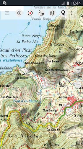
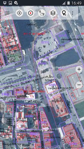
Comprehensive Map Coverage: Access detailed topographic maps and high-resolution aerial views of Spain, including the islands.
-
Versatile Map Layers: Choose from a wide selection of map layers, including Spain's national topo map, OpenStreetMaps, ESRI maps, and more (Spain Topo Map, IGN Base Map, Spain Imagery, Catalonia Topo Maps, Land Register Map, OpenStreetMaps, OpenCycleMaps, ESRI Topographic, ESRI Aerial Images, ESRI Street Map, Google Road Map, Google Satellite Images, Google Terrain Map, Bing Road Map, Bing Satellite Images, and Earth At Night).
-
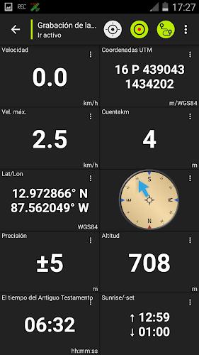
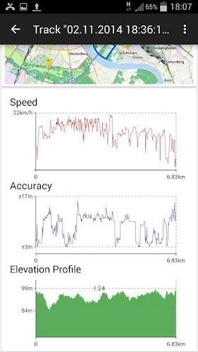
Advanced Navigation Tools: Create and edit waypoints, record tracks with detailed data (speed, elevation, accuracy), and utilize a tripmaster with customizable odometer, speed, bearing, and elevation readings. Export your data in GPX/KML/KMZ formats. Search for locations, points of interest, and streets. Share waypoints, tracks, and routes. Replay your tracks.
-
Pro Version Enhancements (In-App Purchase): Unlock offline map downloads, route creation and navigation, GPX/KML/KMZ import, unlimited waypoints and tracks, custom map tile servers, and an ad-free experience.
-
Free Map Preloading: Download free map data for offline use in areas without cell coverage.
In short: Spain Topo Maps offers a rich feature set for outdoor enthusiasts. Its multiple map layers, customizable data fields, and robust pro features make it an indispensable tool for hiking, biking, camping, and other adventures in Spain. Download now and explore with confidence!